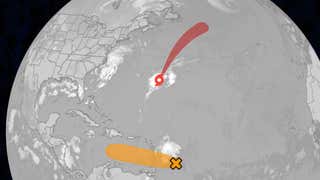
Latest On Fernand And Other Area To Watch
The first hurricane of the 2025 Atlantic Hurricane Season, Hurricane Erin, was a doozy, having undergone explosive rapid intensification from a tropical storm to Category 5 intensity in just under 30 hours.
The system remained a tropical storm for several days as it traveled westward across the Atlantic, even weakening slightly as it battled cooler waters.
Thanks to warmer waters in the western Atlantic, Erin began a period of explosive rapid intensification starting on August 15, going from a tropical storm to Category 5 in just under 30 hours, and from a Category 3 to a Category 5 in just under 6 hours.
Erin has also joined a rare group of only five hurricanes that have wind speeds of at least 145 mph by August 16 since 1970, according to Dr. Phil Klotzbach. Erin is the first Category 5 hurricane since Milton and Beryl in 2024.
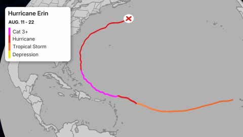
The track history of Erin over 11 days from mid- to late-August 2025. The final advisory by the National Hurricane Center was indicated by the “X” in the northwestern Atlantic on August 22.
(Data: NOAA/NHC)
Erin began to undergo an eyewall replacement cycle on Saturday, setting off a period of fluctuation in intensity and bringing the storm back to Category 4 intensity by Saturday evening.
While Erin ultimately skirted around islands in the Caribbean, a wind gust of 57 mph was recorded on the island Tortola in the British Virgin Islands, but sustained tropical storm force winds remained to the north of the islands.
Erin dumped up to 6 inches of rain in Puerto Rico and up to 7 inches of rain in the U.S. Virgin Islands, according to the National Weather Service.
Following the eyewall replacement cycle, Erin began to significantly grow in size. At its largest, the storm had a peak diameter for tropical-storm-force winds of 480 miles and hurricane-force winds of 150 miles.
US Impacts
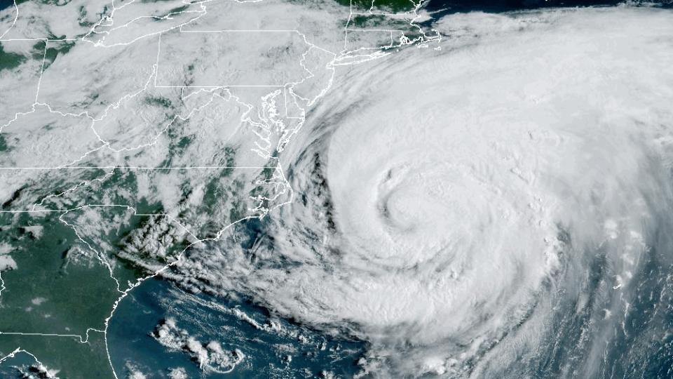
While Erin never made direct landfall on the U.S., the storm’s large size and intense strength allowed it to produce dangerous surf conditions and rip currents up and down the East Coast.
(MORE: Dozens Rescued From Hurricane Erin Rip Currents)
A NOAA buoy about 170 miles east of Hatteras near the center reported winds gusting to 85 mph and up to 45 foot waves early Thursday morning.
Wind gusts as high as 53 mph were clocked in the Outer Banks of North Carolina, and gusts of at least 40 mph have been measured from the Virginia Tidewater to coastal Delaware and the Jersey shore.
The area hardest hit area by Erin was the Outer Banks, with reports of significant overwash of Highway 12 and also on the sound side of Ocracoke Island. A tide monitoring station in Duck, North Carolina, also reached major flood stage Thursday night.
Jennifer Gray is a weather and climate writer for weather.com. She has been covering some of the world’s biggest weather and climate stories for the last two decades.
Jonathan Erdman is a senior meteorologist at weather.com and has been covering national and international weather since 1996. Extreme and bizarre weather are his favorite topics. Reach out to him on Bluesky, X (formerly Twitter) and Facebook.

