Our latest cold front, having swept through Central Texas and shifted east, has left behind a noticeable change in the air. A seasonably cooler, more winter-appropriate air mass has taken over, with morning temperatures back in the 30s and 40s and afternoons only in the 60s on Sunday.
The only drawback of this latest front is that it arrived without any rain, drawing into the region only very dry air, open skies, and breezy north winds instead. That combination has heightened the risk of fast-spreading wildfires across the state. Already, numerous fires have broken out across the Texas Panhandle since early last week.

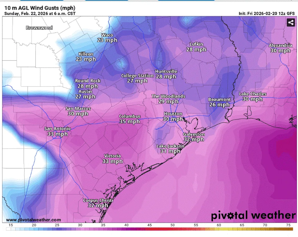
Gusty winds in South and Central Texas could be as strong as 25 to 30 mph on Sunday afternoon, especially east of Interstate 35. (Pivotal)
After a critical wildfire threat Saturday, a near-critical wildfire threat is expected Sunday for areas south of Round Rock and east of Interstate 35, where north winds will remain gusty at 20 to 25 mph.
Winds will relax Sunday night and, under clear skies, enough cooling by Monday morning could support a brief, patchy light freeze in the low-lying spots of the Hill Country and along the Balcones Escarpment.

Temperatures across South and Central Texas could dip to near freezing in the Hill Country early Monday. (Pivotal)
AUSTIN FREEZE: Is it time to declare winter over?
A ridge of high atmospheric pressure will build over the desert Southwest and then slide east into Texas early in the work week, setting the stage for a gradual but steady warming trend.
Austin’s afternoon temperatures will remain in the 60s on Monday, then rise above late-February climate-averages, into the 70s, on Tuesday. Even warmer air arrives Wednesday, as the strong southerly flow strengthens ahead of an atmospheric disturbance passing north of Texas. Austin temperatures on Wednesday will reach the low 80s.

Austin temperatures will end February at above climate-normal levels, according to the National Weather Service. (National Weather Service)
A trough of low pressure is forecast to move into Central Texas on Thursday, but questions remain about how quickly it will arrive and how strong it will be.
“If that air is slow to arrive with a weaker trough, then conditions are favorable on Thursday to register the warmest air of the week with highs in the mid-80s to low-90s as northwesterly winds favor down sloping along the Balcones Escarpment,” meteorologists at the National Weather Service wrote in their daily weather discussion. “Otherwise, a stronger and faster trough could bring some slight temperature reductions for Thursday and Friday if that air trends faster.”

Weather patterns in Texas will transition to wetter than normal for the first week of March, according to the National Weather Service’s Climate Prediction Center. (Climate Prediction Center)
Either way, temperatures will be about 10 to 15 degrees warmer than Austin’s late-February average of 69 degrees.
No rain is in the forecast for the next week, but the extended two-week outlook shows a slight pattern change, with increased moisture, stronger cold fronts, and a good chance of rain during the first week of March.