Published on
July 15, 2026

Image generated with Ai
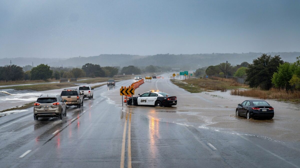
United States pairs up with Mexico and Canada across North America’s interconnected travel network as dangerous Texas flash flooding disrupts road journeys around San Antonio and communities farther west. Heavy rain has covered highways, closed low-water crossings and forced rescues in Uvalde, Medina and Bandera counties. Water also slowed vehicles on US Highway 281 near Brook Hollow Boulevard, while additional trouble affected Interstate 10, Interstate 35 and local routes across Bexar County. The emergency has become an important travel story because the affected corridor connects major cities, border communities, river resorts, state parks and rural destinations used by domestic and international visitors.
The greatest confirmed impacts were not in central San Antonio but along the US 90 corridor to its west. Uvalde County recorded 6 to 16 inches of rain within 24 hours, alongside numerous water rescues and impassable sections of US 90 and US 83. Texas activated an escalated emergency response and declared a disaster across 59 counties as repeated storms threatened saturated ground. With further rainfall capable of reaching 2 to 4 inches an hour, travellers face changing road conditions, delayed journeys and serious risks near rivers, campsites and crossings. Conditions must be checked before every journey now.
Texas Flash Flood Emergency Extends Beyond San Antonio
High water seen on US 281 near Brook Hollow Boulevard brought the emergency into focus for San Antonio commuters. Flooding reduced traffic speeds while crashes and standing water affected other major corridors. Bexar County reported approximately 12 to 16 closures at different points as conditions changed.
Nevertheless, the deeper emergency was unfolding west of the city. Repeated thunderstorms produced extreme rainfall over rural communities, rapidly filling creeks and covering roads. Shelters were opened or prepared in Uvalde and Sabinal, while residents were advised to avoid unnecessary journeys.
Advertisement
Advertisement
Hardest-Hit Travel Areas Across the United States
This flooding remained concentrated in Texas. No evidence showed that this specific event had produced comparable impacts in other US states. The leading affected areas were ranked using rainfall, rescues, road closures and evacuation activity.
| Area | Confirmed travel and community impact |
|---|---|
| Uvalde County | Between 6 and 16 inches of rain, numerous water rescues, shelters and impassable sections of US 90 and US 83 |
| Medina County | Heavy rainfall, four reported rescues, more than 36 road closures and dangerous runoff around creeks |
| Bandera and southern Real counties | Between 3 and 9 inches in warned areas, more than 20 closures, overflowing waterways and voluntary RV park evacuations |
| San Antonio and Bexar County | High water on US 281, I-10 and I-35, traffic congestion, crashes, power cuts and low-water crossing closures |
| Kerr, Kendall and Comal counties | Flooded streets in Kerrville, approximately six inches near Boerne and closures around Cibolo Creek and local crossings |
Uvalde County experienced the most serious confirmed disruption. Sabinal, Knippa, Concan, Uvalde, Utopia and areas near Garner State Park remained vulnerable to further flooding. Travellers staying beside the Frio, Nueces and Sabinal rivers faced particular danger from delayed upstream runoff.
Advertisement
Advertisement
Powerful Weather Pattern Drives Repeated Downpours
The emergency was not caused by a named hurricane. A rotating thunderstorm system near Del Rio combined with deep tropical moisture, unstable air and a stalled weather boundary. Moist air was repeatedly carried towards the Texas Hill Country, where rising terrain encouraged further storm development.
Thunderstorms then travelled over locations that had already received extreme rain. This training effect increased runoff because saturated ground could absorb little additional water. Rainfall rates between 2 and 4 inches an hour were considered capable of producing life-threatening flash flooding.
Major Roads and Visitor Destinations Face Uncertain Access
Floodwater affected US 90 between Knippa and Sabinal, while parts of US 83 also became impassable. Around San Antonio, high water or crashes disrupted US 281, I-10 and I-35. Conditions at low-water crossings remained especially unpredictable.
River resorts, camping grounds, RV parks and nature destinations around Concan, Rio Frio, Utopia and Garner State Park faced growing risks. The Frio River at Concan was expected to reach minor flood stage, threatening low roads, bridges and recreational areas. Trails at Guadalupe River State Park also faced restrictions because of unsafe conditions.
No flood-related closure of San Antonio International Airport had been confirmed. However, thunderstorms could still cause operational delays, while flooded approach roads could complicate airport journeys. Passengers were advised to check airline schedules separately from road conditions.
Texas Activates Escalated Emergency Response
A disaster declaration covering 59 Texas counties enabled faster deployment of personnel and equipment. The State Emergency Operations Centre continued round-the-clock work at Level II, classified as an escalated response.
Advertisement
Advertisement
Transportation crews, medical teams, search-and-rescue personnel, Texas Parks and Wildlife officers, public safety agencies and the Texas National Guard were prepared for deployment. The response concentrated on protecting communities, conducting rescues and managing flooded transport corridors.
Further Rain Keeps Travel Risk Elevated
The Weather Prediction Center placed parts of the Edwards Plateau, Rio Grande Valley and western Hill Country under its highest excessive-rainfall category. Additional pockets of 10 to 20 inches were considered possible in the most vulnerable zone.
San Antonio and surrounding areas remained within a broader serious-risk region. Flooding could continue after rainfall stopped because rivers and creeks respond to upstream water later. Road reopening schedules therefore remained uncertain, particularly around rural bridges and low-water crossings.
Frequently Asked Questions
What happened in San Antonio?
Heavy thunderstorms caused standing water, highway disruption, crashes and closures at flood-prone crossings across Bexar County.
Which area was affected most severely?
Advertisement
Advertisement
Uvalde County suffered the strongest confirmed impacts, including extreme rainfall, water rescues, impassable highways and emergency shelter preparations.
How much rain fell in Uvalde County?
National Weather Service information indicated that approximately 6 to 16 inches fell in parts of the county within 24 hours.
Was US Highway 281 completely closed?
High water and traffic disruption were reported near Brook Hollow Boulevard, but motorists must consult live TxDOT information for current closures.
Is US 90 safe for travel?
Advertisement
Advertisement
Sections between Knippa and Sabinal became impassable. Conditions can change rapidly, making official road checks essential before departure.
Is San Antonio International Airport operating?
No flood-related airport closure was confirmed, although passengers could encounter weather delays and difficulty reaching terminals by road.
Are Texas river resorts and campsites affected?
Properties near the Frio, Nueces, Sabinal and Medina waterways face risks from rising water, flooded bridges and delayed upstream runoff.
How long will the flood threat continue?
Advertisement
Advertisement
Flood watches and serious rainfall risks were expected to remain through Thursday, with river flooding potentially lasting beyond the storms.
Were any deaths reported?
No fatalities or serious injuries had been officially confirmed in the latest available reports, although the emergency remained active.
What should travellers do before leaving?
Travellers should check DriveTexas, Bexar County flood information, National Weather Service warnings and airline updates before every journey.
Advertisement
Advertisement