LIVE UPDATES: Tropical Storm Crising
Image from DOST / Pagasa
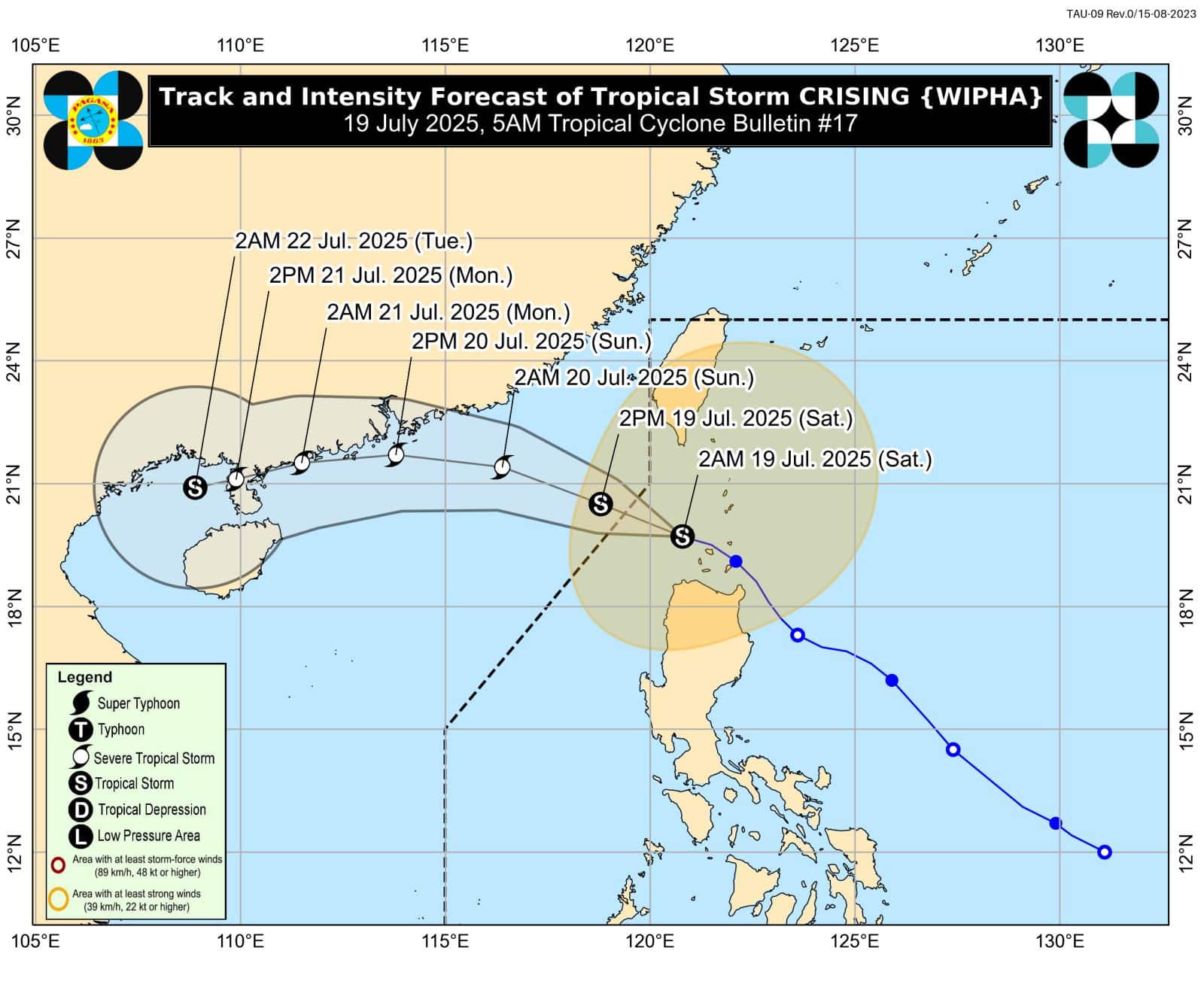
MANILA, Philippines — Severe Tropical Storm Crising (international name: Wipha) is projected to become a typhoon by Sunday as it moves toward southern China, according to the Philippine Atmospheric, Geophysical and Astronomical Services Administration (Pagasa) in its latest weather update.
Crising exited the Philippine area of responsibility (PAR) on Saturday morning, the state weather bureau said in its most recent tropical cyclone bulletin.
“It will continue moving generally west-northwestward toward southern China for the rest of the forecast period,” Pagasa explained.
“Crising is forecast to continue intensifying and may reach typhoon category tomorrow afternoon or evening.”
At a press conference on Saturday morning, Pagasa weather specialist John Manalo said in Filipino: “Even though Crising is now moving farther away from the country, the effect of the southwest monsoon will persist. This will still bring cloudy skies and rain.”
READ: Crising intensifies into severe tropical storm as it exits PAR
The severe tropical storm was packing maximum sustained winds of up to 100 kilometers per hour, with gusts of up to 125 kph, while moving west-northwestward at 15 kph.
Crising was last spotted 235 kilometers west of Itbayat, Batanes, which means the cyclone is now outside the PAR. /jpv