Two tropical storms in close proximity – Hurricanes Humberto and Imelda – are going to have a significant impact on our weather at the end of this week
Wales is set to be battered by rain and wind this weekend as two tropical storms traverse the Atlantic towards our shores. Meteorologists at the Met Office anticipate that former hurricane Humberto and Imelda could deliver “wet and windy conditions” across much of Britain from Thursday through to Saturday.
The weather service has cautioned that weather warnings may well be issued later this week. Wales is currently experiencing a calm beginning to the week with numerous dry periods courtesy of high pressure in the region.
However, the ex-hurricanes are poised to trigger a dramatic transformation in our weather systems, with Met Office charts indicating Wales will bear the brunt of substantial rainfall on Thursday, Friday and Saturday. For the biggest stories in Wales first, sign up to our daily newsletter here
Wind speeds of up to 60mph have been forecast to reach the north coast of Wales by Thursday evening – and this is the start of a turbulent week.
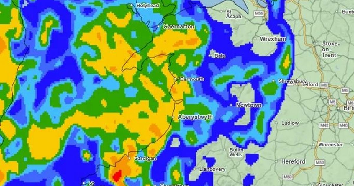
At the same time, rain will also be lashing down on most of the nation.
The wind will worsen on Friday, with winds reaching 60mph in the west coast.
Rainfall, with varying severities, will be experienced across the nation at the same time.
By Saturday morning, rainfall will become less intense, but wind speeds will hit their peak, exceeding 62mph in some areas. These wind speeds have been known to shut major roads, such as the Severn Bridges.
Hurricane Humberto sits south of Bermuda at present, and has intensified in recent days to reach major category 5 status. The storm is anticipated to deliver destructive winds to the island.
Following remarkably close in Humberto’s wake, a second tropical system called Imelda has developed, which forecasters predict will also intensify into hurricane strength as it travels north of the Bahamas.
While Humberto will have weakened from hurricane status by week’s end as it approaches the UK, it remains likely to bring disruptive conditions to our coastline.
These weather patterns could mark a pronounced departure from Wales’ forecast for the remainder of the week, which is predicted to stay predominantly dry.
BBC weather presenter Matt Taylor outlined the potential impact of former Hurricane Humberto on the nation’s weather during BBC Breakfast: “It is going to weaken further and fragment into a wider area of low pressure. But as it starts to head towards us across the Atlantic it could re-strengthen again and create quite a deep and potent area of low pressure.
“Heavy rain could sweep the country, with the potential for some disruptive winds.” He emphasised it was worth “keeping an eye on the forecast” in the coming days.
The Met Office confirmed these former tropical cyclones brought considerable uncertainty to weather predictions.
Deputy chief meteorologist Chris Bulmer explained: “The situation becomes more complex later in the week as tropical cyclones Humberto and Imelda, currently over the southwest Atlantic, influence our weather, increasing the risk of a deep low developing near the UK.
“If this materialises, we could see some very strong winds as well as further heavy rainfall Friday into Saturday, but at this time the development and track of this system remains uncertain. We’re monitoring this closely.”
Given the possibility that the Met Office may issue warnings as conditions become clearer, the public is advised to keep updated with the latest forecasts.