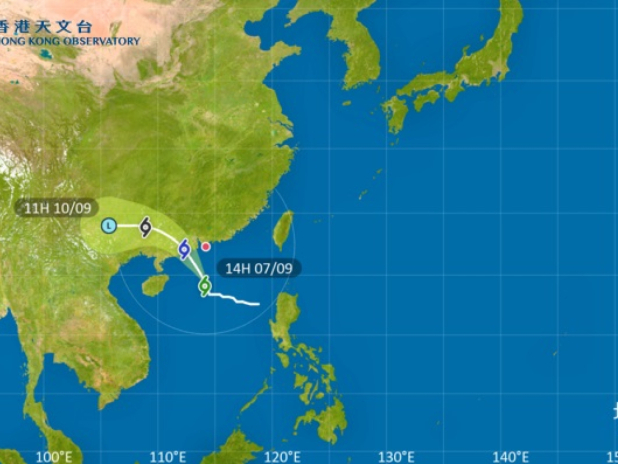
The Observatory said the storm had moved north-northwest steadily in the past couple of hours, and its outer bands of thundery showers are affecting the coast of Guangdong.
At 3pm, Tapah was about 340 kilometres south of the SAR and was forecast to move north-northwest at about 18 kilometres per hour.
The forecaster said the storm will skirt within 200 kilometres southwest of Hong Kong on Monday morning, with its associated gale winds affecting the vicinity of the Pearl River Estuary gradually.
The Strong Wind Signal No. 3 was issued at 2.40am and the Observatory has said it would remain in force for most of the day.
It said the city will be hit by occasional squally showers and thunderstorms throughout Sunday, with heavy squally showers and windy weather on Monday.