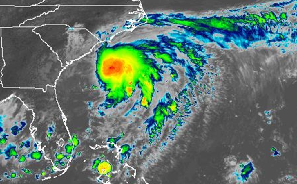
Tropical Storm Chantal formed Saturday as it slowly moved in the Atlantic toward the Carolinas, according to the National Weather Service.
What had been Tropical Depression Three that formed off the coast of Florida on Friday grew into the season’s third named storm by 8 a.m.
As of the NHC’s 5 p.m. advisory, the storm’s center was located about 95 miles south-southeast of Charleston, S.C. and 165 miles south-southwest of Wilmington, N.C. with maximum sustained winds of 45 mph moving north at 7 mph.
Tropical-storm-force winds extend out up to 140 miles, mostly east of the system’s center.
A tropical storm warning is in effect from the South Santee River, S.C. north to Surf City, N.C. while a tropical storm watch is in effect from Edisto Beach, S.C. to the South Santee River.
“A motion toward the north-northwest is expected to begin this evening, followed by a turn to the northeast by Sunday night,” forecasters said. “On the forecast track, the center of Chantal is expected to move across the coast of South Carolina overnight or early Sunday morning.”
#Chantal expected to bring tropical storm conditions, heavy rainfall, and life-threatening rip currents to portions of South and North Carolina later today through Sunday. Here are the Key Messages. Visit https://t.co/tW4KeGe9uJ for details pic.twitter.com/zk3aXIIKSv
— National Hurricane Center (@NHC_Atlantic) July 5, 2025
The system for now is just over the minimum threshold for tropical storm status, but could strengthen before landfall. Rapid weakening is expected after landfall.
The system that led to heavy rain that struck Florida on Thursday and Friday is expected to bring 2-4 inches of rain, with some areas getting up to 6 inches across the coastal plain of the Carolinas.
Storm surge could be from 1-3 feet from the South Santee River to Surf City, N.C. and 1-2 feet from Edisto Beach to the South Santee River. Dangerous surf and rip currents are forecast from northeastern Florida to the mid-Atlantic over the next couple of days.
Isolated tornadoes are also possible into Sunday along the coast of eastern South Carolina and much of North Carolina, the NHC stated.
Chantal is the first storm of the 2025 Atlantic hurricane season to threaten the United States.
The National Oceanic and Atmospheric Administration forecasts 13 to 19 named storms this year, of which 6-10 will become hurricanes. Three to five of those would grow into major hurricanes of Category 3 strength or higher.
Hurricane season runs June 1-Nov. 30.
Originally Published:


