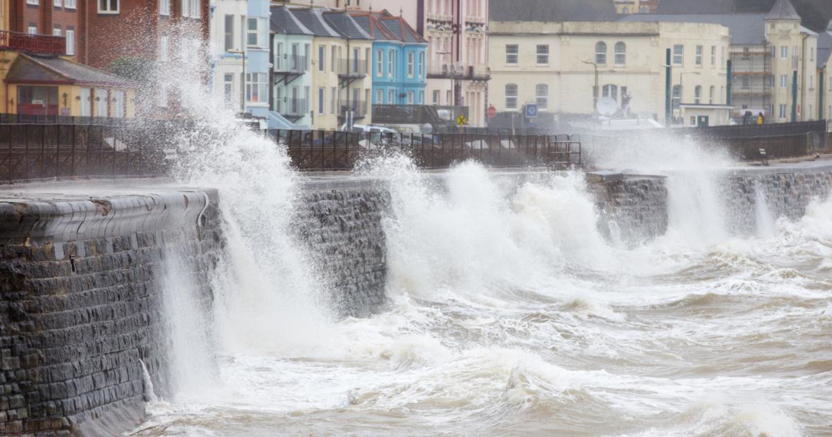
Storm Amy is sweeping in from the Atlantic and is the first named storm of the season with winds of up to 95mph predicted on Friday.
The Met Office has issued weather warnings across the UK but Scotland in particular will be hit badly by the storm.
The north and west of Scotland will be worst hit by the storm on the British mainland, with a Met Office amber warning for “damaging winds” in place from 5pm on Friday until 9am on Saturday.
Staying safe during a thunderstorm
Storm Amy set to batter the UK from today
Those living in parts of the Highlands and Western Isles have been warned of a “danger to life” from flying debris, potential power cuts as well as road closures and damage to buildings.
Flood warnings are also in place for parts of Scotland with travel plans expected to be disrupted across the UK.
All of Scotland, the north of England and the most western parts of Wales will fall under yellow warning for wind from 3pm on Friday until the start of Sunday.
A long strip of Scotland running from Dumfries up to the northern-most part of the mainland will also fall under a yellow rain warning from 12pm on Friday to 3pm on Saturday.
A yellow rain warning is also in place for the north-west of England, including the Lake District, from 3pm until midnight.
The first glimpse of #StormAmy on Friday morning, as a band of heavy rain arrives in the west with increasingly strong winds ⚠️
Warnings are in force during the afternoon, keep up to date with the latest here 👉 https://t.co/QwDLMfS950 pic.twitter.com/LEcwYEWYKl
— Met Office (@metoffice) October 2, 2025
The Met Office warned gusts up to 70mph will be felt “fairly widely” while “more exposed areas” could see winds of up to 95mph along with spells of heavy rain across the country.
The forecaster said: “Storm Amy is expected to bring a spell of strong winds to many parts of northern and western Britain later on Friday and overnight into Saturday.
“South to southwesterly winds will increase during Friday, initially in the west before extending eastwards during Friday night.
“Gusts of 50-60 mph are likely in many areas, and may reach 60-70 mph in more exposed parts.
“The strongest winds are most likely across portions of northern and western Scotland, where gusts in excess of 90 mph are possible – this is covered by a separate Amber warning for the Friday night period.”
How to track Storm Amy
The Met Office’s tracker allows you to see the movement of Storm Amy throughout the next few days.
The Met Office storm tracker also allows you to see the impact of the storm with the rainfall, wind gusts, cloud cover and temperature all available to see.
You can access the storm tracker via the Met Office website..
What advice has the Met Office given ahead of Storm Amy?
The Met Office said: “Check if your property could be at risk of flooding. If so, consider preparing a flood plan and an emergency flood kit.
Recommended reading:
“Give yourself the best chance of avoiding delays by checking road conditions if driving, or bus and train timetables, amending your travel plans if necessary.
“People cope better with power cuts when they have prepared for them in advance. It’s easy to do; consider gathering torches and batteries, a mobile phone power pack and other essential items.
“Be prepared for weather warnings to change quickly: when a weather warning is issued, the Met Office recommends staying up to date with the weather forecast in your area.”