Heavy rainfall, wind gusts up to 50 mph and isolated thunderstorms are possible late Sunday as a cold front rips across the state following a warm, dry and breezy day, forecasters say.
Northeastern New Jersey counties could see rainfall rates up to 1 inch per hour and localized flooding is possible, according to the National Weather Service’s New York office, which covers Bergen, Essex, Hudson, Passaic and Union counties.
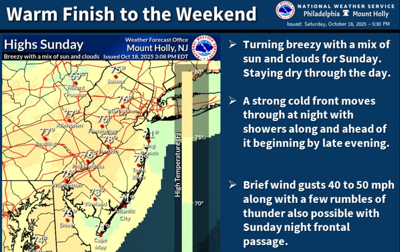
“It will be a warm finish to the weekend before some gusty showers move through tomorrow night,” the weather service’s New Jersey office said Saturday evening. “The good news is it will stay dry through the daylight hours of Sunday.”
Rainfall totals through Monday morning are expected to range from a quarter-inch to 1.25 inches, with locally higher amounts potentially reaching 2 inches in less than 6 hours.
Temperatures will climb into the upper 60s to mid-70s on Sunday with breezy conditions during the day and gusts up to 30 mph.
“Temperatures on Monday are expected to be around 10 degrees lower than Sunday, with highs ranging from the mid 50s to mid 60s,” the weather service said.
Drier and cooler conditions expected Tuesday through Thursday.
Temperatures will return to near normal for this time of year, with predominantly dry conditions and occasional breezy winds.
Current weather radar
If you purchase a product or register for an account through a link on our site, we may receive compensation. By using this site, you consent to our User Agreement and agree that your clicks, interactions, and personal information may be collected, recorded, and/or stored by us and social media and other third-party partners in accordance with our Privacy Policy.