The UK is set to be hit by heavy downpours and gale-force winds as meteorologists deliver a frightful forecast on Halloween, with western areas feeling the worst of it
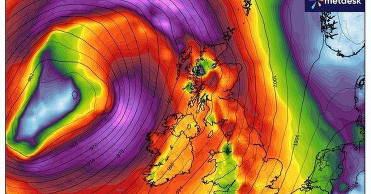
Britain faces a horror day of weather on Halloween as heavy rain and gale-force winds are set to batter the nation. Gusts of up to 80mph are expected to hit coastal areas, weather charts show.
And trick or treaters may need to take shelter as the worst of the weather is set to arrive on Friday night. It is expected to linger until Saturday morning. Weather maps from WXCharts show western coastlines are likely to take the biggest brunt of the frightful forecast.
The western coasts of England and Scotland were battered on Thursday, with northern areas including Dumfries and Galloway and Cumbria, as well as Northern Ireland, primarily affected.
But even as far south as Hampshire, gusts could reach 70mph, forecasters say. Alongside the gale-force winds, there will be heavy bouts of rain, with some parts of the UK seeing up to 20mm of accumulated rainfall, according to the forecast.
The rain and windy conditions will take hold from around 3pm today, meteorologists say. With such severe gales expected, forecasters have suggested delays across road, rail and ferry services are possible. Coastal regions could also face large waves and spray throughout the afternoon and into the evening.
By around 6pm, it will be wet across most of the country, though heaviest across western Scotland. The Scottish Highlands will see the most rain throughout Halloween evening.
It follows a rainy day on Thursday for many too, especially those across Northern Ireland and Wales. Nearly 20mm of rain fell across County Antrim, data recorded for the Met Office shows. More than 13mm of rain battered Pembrokeshire, south Wales, on Thursday.
And these areas are vulnerable to further deluges today too, the weather maps indicate. The Met Office also anticipates “unsettled” conditions with some “heavy showers” forecast.
Despite potentially milder temperatures, it will remain “rather windy” across the weekend. The mercury, though, could peak at 16C in the East of England today.
But the turbulent weather looks set to persist into next week as well, with the Met Office’s long-range forecast stating: “The changeable and at times unsettled weather is likely to continue through early November, with low pressure dominating the UK. This means further showers or longer spells of rain at times.
“All parts could see some heavy rain, but it is likely that western areas will be wettest. Strong winds are likely at times, with gales or severe gales a possibility, especially in the west.”
For the latest breaking news and stories from across the globe from the Daily Star, sign up for our newsletter by clicking here.