CNN
—
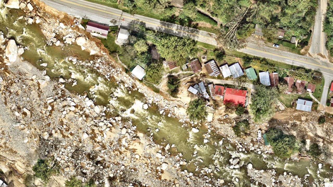
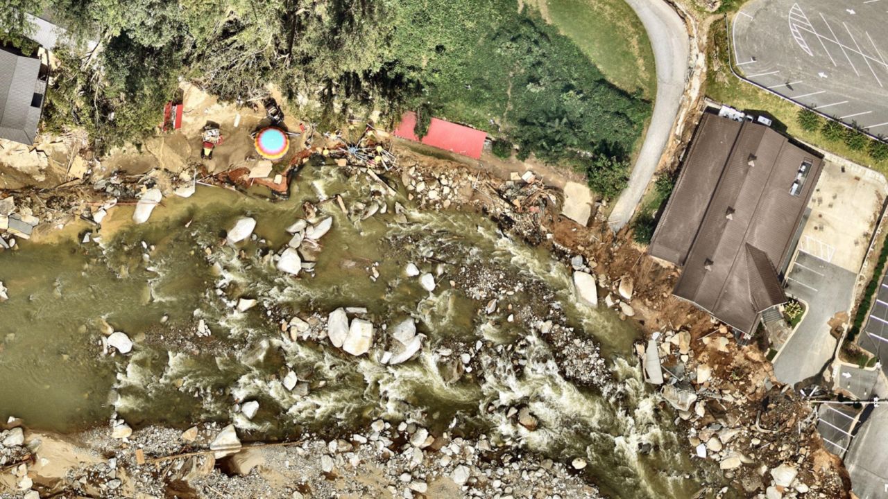
New before-and-after aerial photos paint a grim picture of Hurricane Helene’s devastation in parts of western North Carolina that have been hard to access after the storm swiped away the state’s roads and bridges.
The monstrously sized Category 4 hurricane carved a more than 500-mile path of destruction across the Southeast and has killed more than 200 people – the second-deadliest hurricane to strike the US mainland in the past 50 years.
Many of those deaths are in North Carolina, where the storm’s hallmark was prolific rainfall and historic and catastrophic flooding.
The storm threw down so much water over the southern Appalachians over a 3-day span that it was a widespread once-in-1,000 year rainfall event for the region, according the National Weather Service.
All of that water barreled down the mountains, liquifying the slopes in some places into devastating mudslides that wiped homes off their foundations. But eventually, it all ended up in rivers.
Water levels surged feet higher than they’d ever been observed before, charting a new course as they wiped out dozens of bridges, roads and homes and sent them downstream.
Such was the case in Chimney Rock, North Carolina, which borders the Broad River.
“Everything on each side of the river is gone,” the town’s mayor Peter O’Leary said. “Everything you take for granted has been washed away, literally. Every single business, every single building has been destroyed or severely damaged,” O’Leary told CNN affiliate WSOC-TV.


Chimney Rock was not alone. Even major population centers like Asheville, mistakingly thought a safe haven from extreme weather like Helene being worsened by climate change, took it on the chin.
The images show building after building partially or completely washed away by rivers that burst their banks and simply created new ones.
They also reveal the ongoing challenges to find those still unaccounted for when parts of towns simply no longer exist, and the magnitude of the challenge that lies ahead to restore these places in a landscape now completely changed by Mother Nature.