Published on Nov. 11, 2024, 3:16 PM
A ridge over the Atlantic Ocean will funnel wave after wave of rain into parts of Canada’s East Coast throughout the week
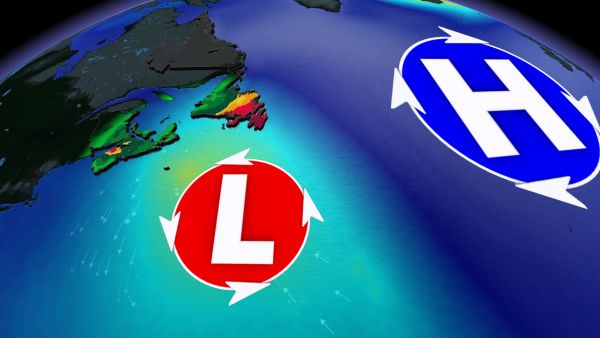
This new workweek of November threatens some unsettled weather across parts of Atlantic Canada. The region will essentially be “stuck” in an atmospheric gridlock, with systems lingering over the East Coast for much of this week.
Brace for heavy rain and powerful winds as a result of the back-to-back storms, with localized flooding and power outages some potential impacts through the week. A temperature rollercoaster could also bring some localized mixed precipitation to higher terrain.
DON’T MISS: What’s the snowiest month in your corner of Canada?
Rounds of unsettled conditions this week
A strong high pressure system off the coast of Europe is going to prevent systems from tracking through Atlantic Canada this week, and instead will have them lingering over the region for days on end.
After a milder and wet start to the week on Monday, a second system will track in on Tuesday, bringing rain to the Maritimes, and even some localized mixed precipitation to some higher terrain as temperatures fall.
The system then pushes into Newfoundland, stalling out just south of the Avalon Peninsula. The system will be wedged between the high off the coast of Europe and an incoming high pressure system from Ontario and Quebec.
This pattern sets up a boundary over central and eastern Newfoundland, which can bring persistent heavy rain from Tuesday night through Thursday. Current forecast models suggest that 50-100+ mm of rain could fall during this time period.

