COLUMBUS, Ga. (WRBL)- Happy Friday! After a few showers earlier today, this evening has dried out. Overnight readings will sit in the 40s for the beginning of Saturday.
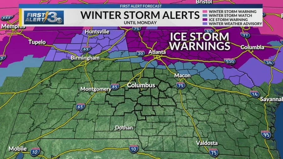
Weekend: Overcast skies will continue for the weekend as we track a major winter system moving across the United States. Rare Ice Storm Warnings are in effect to our north across parts of Atlanta. Locally, no alerts are in place for the WRBL area for now.

A mix of snow, ice, and rain will build across the southeast Saturday evening. While most of this will remain to our north, there is a possibility of light icing across our northern counties (Meriwether and Troup). Minor travel impacts are possible in those areas that do see small ice accumulation. Overall, most areas will just see rain.
Sunday afternoon, we will be tracking a low-end risk for severe weather. Our primary threats are strong winds and a brief spin-up tornado.
Next Week: Behind this system, temperatures will plummet Monday. Expect lows in the 20s with wind chills in the teens. Tuesday is shaping up even colder. Actual lows will be in the teens (wind chills in the single digits for some). We will continue to see morning temperatures well below freezing for the rest of the week. Plus, we are tracking another strong cold front at the end of the week.
Copyright 2026 Nexstar Media, Inc. All rights reserved. This material may not be published, broadcast, rewritten, or redistributed.
For the latest news, weather, sports, and streaming video, head to WRBL.