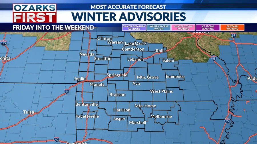
Winter Storm Watches are now in effect across the Ozarks. The watch runs from Friday into Sunday. Snow is expected to begin in the Ozarks late Friday afternoon into Friday night and continue on and off into Sunday morning.

The expansion of the watch further north is due to increased confidence that higher totals will occur further north. The model guidance today has shifted the overall storm track a bit further north, resulting in higher levels of moisture being transported further north across the Ozarks.
There is greater confidence that most of the Ozarks will see at least 5″ of snow. It still appears that there will be a sharp cutoff of the higher amounts on the northern edge as dry, arctic air influences snow totals. That cutoff should occur near Central Missouri.

Amounts in excess of half a foot appear likely near and south of the state line. This is also where the snow will tend to be “wetter”, with more of a sugary or powdery snow further north.


This will be a widespread winter storm with impacts from New Mexico to the Carolinas. An ice storm is expected on the southern edge with a broad area of winter mix from Texas east through Tennessee. For the Ozarks, it looks like primarily snow.
We’re still a few days out from the storm. Expect additional changes to the forecast and stay apprised of the latest developments. There is high confidence that this will be a very impactful winter storm across the region. Prepare now for the coming snow and cold. And, make adjustments to travel plans if needed.
Copyright 2026 Nexstar Media, Inc. All rights reserved. This material may not be published, broadcast, rewritten, or redistributed.
For the latest news, weather, sports, and streaming video, head to KOLR – OzarksFirst.com.