The Hawaii Department of Transportation launched two free mobile apps this week, one for Honolulu Airport and one for Lihue Airport, aimed at reducing confusion and saving time. We tried them, and aside from a basic blue-dot navigation feature, there wasn’t as much new as we had hoped. The apps may not go far in solving the deeper problems travelers face at Hawaii’s airports.
Honolulu Airport has long been a maze of long walks, confusing signage, and unexpected bottlenecks that we’ve written about many times. The Lihue airport is petite and much easier to navigate, with only one terminal and a limited number of gates and amenities. According to the press release, the next airport to get its app will be Maui.
How the new Hawaii airport apps work.
The HNL Airport and LIH Airport apps utilize indoor blue-dot navigation, similar to what is found in mapping programs. Once inside the airport, your position is displayed on a terminal map, along with step-by-step guidance to check-in counters, gates, baggage claim areas, restrooms, food and shopping options, agricultural inspection stations, and ground transportation options.
HNL’s app also includes live parking availability, updated every ten minutes. Travelers can view the open spaces in each parking structure before entering. This system is tied to LED counters installed in 2022; however, that information was previously only visible at the lot entrances. If the LIH app also had parking availability, that would be a good reason for us to use it regularly.
Is there anything new here?
We’ve already spent time on the Hawaii DOT Airports website, and there’s nothing novel to a significant degree, other than the blue dot navigation, which we found not particularly useful, but maybe it will be for some people. If you further scrutinize the Hawaii Airports website, you’ll find the same thing we did: that pretty much everything was already there, working well overall.
At Lihue, it’s even harder to see the point. You walk in, and there are just a handful of gates to the left and another handful to the right, plus a Starbucks, a small cafe, a souvenir shop, and a bar located in the center, past security. There’s nothing there to navigate, so it feels like an app for the sake of having an app.
In Honolulu, the app comes across the same way. Most of the content already existed on the DOT Airports website, and the app pulls or links from there. It feels more like what hotels and vacation rental companies do with their travel apps, which are often largely wrappers for existing websites rather than true apps, with added tools and unique information.
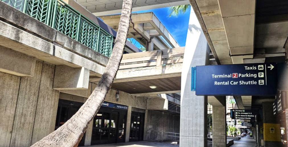
Why this matters for HNL travelers.
HNL is Hawaii’s busiest airport and remains its most challenging to navigate. In that case, the app may prove helpful. We noted it has not been downloaded many times in the app stores to date, however. In any event, connections between the mainland and neighbor islands can involve lengthy walks, shuttle rides, and tight schedules.
The Mauka Concourse, opened in 2021, added much-needed space but is a very long trek from the main terminal, especially Terminal 2. So if, for example, you flew interisland on Southwest to connect to a Hawaiian mainland flight, you could easily spend fifteen minutes or longer walking there, or waiting for the Wiki-Wiki shuttle.
Also confusing is that the Mauka and interisland terminals funnel passengers through agricultural inspections at various points that don’t quite make sense even to us, sometimes creating surprise delays at the gate.
For example, we cleared the USDA at the boarding gate in Honolulu’s Mauka Terminal last week. However, if you are heading to Terminal 2 gates, you must clear USDA terminal-wide upon entry.
Over the years, readers have shared stories of missed flights, wrong turns, and the stress of figuring out where to go and what to do.
Kauai gets wayfinding, too.
The LIH Kauai Airport app brings the same blue-dot navigation to Kauai’s small airport. LIH, as we said, is a fraction of the size of HNL, but crowds can form quickly during peak arrival and departure times. Baggage claim and rental car pick-up lines spill into walkways, and visitors can still lose time trying to figure out where to go next.
Having turn-by-turn directions here feels questionable, since there isn’t much to the airport in the first place. However, it isn’t always clear, even for us residents.
For example, on an Alaska flight this week, baggage claim was on the opposite side of the airport, rather than the one nearest the arrival gate. It confused passengers, even us who live here. Situations like that may be the only time this app proves useful.
What’s next for Hawaii airport apps.
According to the press release, Maui’s Kahului Airport will be the next to receive an app. OGG is known for its multiple wings and changing gate assignments, so wayfinding there may prove more useful than at LIH. Later this year, the new Skyline Lelepaua Station at HNL will also be added to the app.
Will the apps work as promised.
The success of these apps will depend on accuracy and upkeep. Blue-dot wayfinding technology isn’t new, but it depends on reliable positioning and regularly updated information. If the location tracking lags or if shops, gates, and services are outdated, travelers may stop trusting the tool.
The blue-dot feature was not exceptionally accurate or valuable in HNL, and much of the content pointed back to the existing DOT Airports website. That said, if the technology is improved and maintained, these apps could still become one of the more practical airport upgrades Hawaii has seen in years.
Where to get the apps.
The HNL Airport and LIH Airport apps are free on both the Apple App Store and Google Play. Installation is quick and easy, with no account or sign-in required. Ensure the app displays’ Hawaii DOT Airports’. To find the Lihue app, we had to use the search term “LIH Airport”.
Would you use these apps on your next trip to Hawaii? What has been your biggest challenge navigating HNL or LIH?
Get Breaking Hawaii Travel News