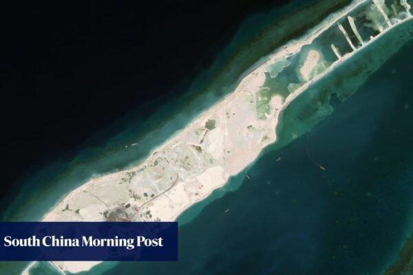
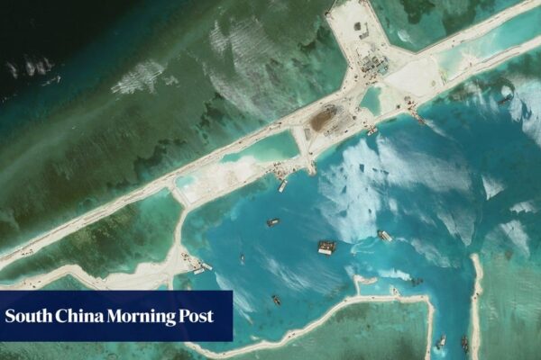
South China Sea: Beijing resources ministry gauges depth of new Vietnamese port on reef

South China Sea: Beijing resources ministry gauges depth of new Vietnamese port on reef

The research combines laser measurements from Nasa’s ICESat-2 satellite with optical data from the European Union’s Sentinel-2 to map underwater changes with unprecedented precision. The team’s peer-reviewed paper was published in the Chinese-language Journal of Tropical Oceanography on February 13. Barque Canada Reef is the largest landform in the Spratly Islands, an archipelago in the…

Read More
South China Sea: Vietnam reef projects and runway may set scene for conflict with Beijing

South China Sea: Vietnam reef projects and runway may set scene for conflict with Beijing

Recent satellite images reveal the emergence of potential military structures on several Vietnamese features in the Spratly Islands and the formation of new embankments enclosing six protected areas. They have been seen across Barque Canada Reef, Central Reef, Tennent Reef, Namyit Island, South Reef and Ladd Reef. 09:23 History, money and military: why the South…

Read More