Southeastern states are seeing high temperatures again Thursday while the Northeast and Midwest get a break from the heat wave. Meanwhile, the Northeast and Mid-Atlantic regions are bracing for excessive rainfall and states in the Midwest are under air quality alerts due to Canadian wildfire smoke.
The Southeast will see temperatures in the high 80s and 90s on Thursday, with “feels-like temperatures” over 100 degrees in multiple places. Those temperatures are about 10 to 15 degrees higher than average temperatures recorded around this time of year.
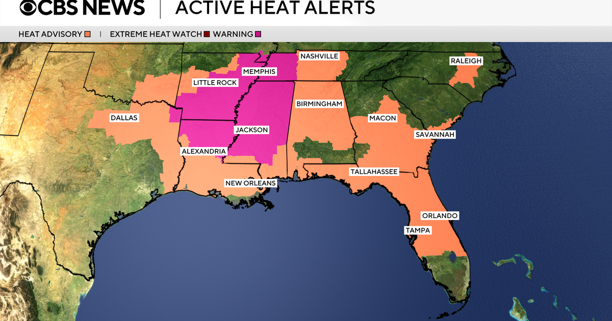
Over 58 million people in the region, including parts of Texas, Alabama and Florida, are under heat advisories through Thursday night. Residents of Arkansas, Tennessee and Louisiana are under extreme heat warnings. Heat warnings mean people should prepare for “extremely dangerous heat conditions,” according to the National Weather Service, while heat advisories are less severe.
CBS News
Heat-related illnesses can increase significantly during times of extreme heat and high humidity. It’s recommended to stay out of the sun and in an air-conditioned room if possible. People should drink plenty of fluids and check on relatives and neighbors.
A cold front has brought temperatures in the high 70s and low 80s to the Northeast and Midwest after multiple days of extreme heat. New York City broke a record earlier in the week: LaGuardia Airport recorded temperatures of 100 degrees Fahrenheit on Tuesday afternoon.
CBS News 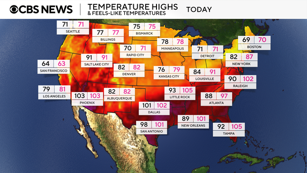
The Northeast and Mid-Atlantic regions are expected to see heavy rain and stormy conditions on Thursday. Some cities may see 3 to 5 inches of rain through Friday, with some areas seeing as much as 7 inches of rainfall. The storms may also bring damaging winds and large hail.
In some regions, rainfall rates may exceed 2 inches per hour, raising the risk of flooding. Over 47 million people are under flood watches through Friday. The highest threat level is for the area between New York City and Washington, D.C.
CBS News 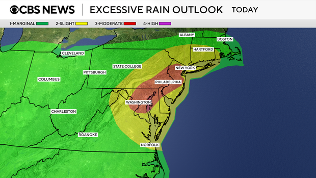
That same cold front is expected to pass through the Southeast, bringing more heavy rain and lowering temperatures over the weekend. Parts of the Southeast may see between 2.5 and 4 inches of rain in the coming days.
CBS News 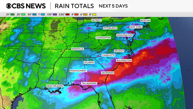
Air quality alerts
Parts of the U.S. are also continuing to see poor air quality from Canadian wildfire smoke. Much of Minnesota, Michigan and Wisconsin are seeing “unhealthy” air quality levels, which means that the general public may experience health effects, according to AirNow. Parts of Illinois, Iowa and North Dakota are also seeing “unhealthy” levels.
In other surrounding states, the air quality level is unhealthy for sensitive groups.
CBS Chicago reported hazy skies and visibility of just two miles as the smoke envelops the city. The smoke is expected to linger through Thursday and into Friday.