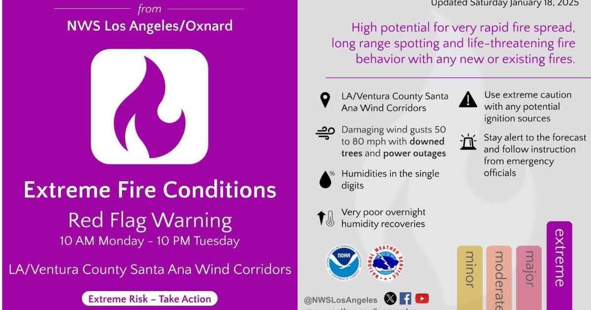
The National Weather Service has issued another rare Particularly Dangerous Situation warning in anticipation of Monday’s powerful and potentially damaging Santa Ana wind event.
The NWS announced on X that the PDS warning for Los Angeles and Ventura counties will take effect Monday at 12 p.m. and remain in place until Tuesday at 10 a.m. The NWS urged the public to prepare accordingly.
According to the NWS, the wind event is expected to develop quickly on Monday, starting in the mountains of L.A. County in the afternoon and spreading into the valleys and coastal areas by evening or early Monday night.
The NWS said there is the potential for wind gusts up to 60 to 80 mph could affect the L.A. and eastern Ventura County mountains Monday night and Tuesday morning, with gusts 55 to 65 mph possible at many valley and coastal areas of these two counties.
Red Flag Warnings to take effect Monday
Combined with humidity lowering significantly to the single digits, a Red Flag Warning has been issued for much of Ventura and Los Angeles counties from late Monday morning through Tuesday evening, including in Pasadena, where the alert will take effect at 8 a.m. Monday through 6 p.m. Tuesday. Parking restrictions have also been put in place there. More information can be found here.
The NWS said these conditions will create “dangerous” fire weather conditions. “New or existing fire ignitions will have a high risk for very rapid fire spread and extreme fire behavior with long range spotting,” the NWS added.
“The most critical days will be Monday and Tuesday, and then Wednesday, Thursday, and Friday, we still are going to see gusty winds, they just won’t be as strong as they will be for the next 48 hours,” said KCAL9’s Meteorologist Marina Jurica.
Jurica said, by 10:40 a.m. on Monday, gusts of up to 60 mph in portions of Santa Clarita Valley, channeling down into Ventura County, western Los Angeles County, moving over into the San Gabriel and San Bernardino County Mountains.
“Like what we saw a couple of weeks ago, winds do create more speed as they move down slop and those down slopping winds we are going to have to really watch for,” Jurica added.
Fire Weather Watch
Gusty offshore winds and very low humidity will continue later Tuesday night through Thursday in these same areas. The strongest winds during this period are expected to be Wednesday night into Thursday morning with gusts in the 40 to 55 mph range. Due to the potential for continue Red Flag conditions, a Fire Weather watch has also been issued for most of these areas from late Tuesday evening through Thursday evening.
High Wind Watches
In addition, High Wind Watches will be in effect late Monday afternoon through Tuesday morning for Ventura and parts of Los Angeles counties due to a “high risk of widespread damaging winds,” according to the NWS.
By Friday, an upper low may bring a chance of light rain and mountain snow, along with cooler temperatures.
Moderate to strong gusts could cause downed trees, power outages and dangerous sea conditions.
Los Angeles County areas of greatest concern:
- Calabasas and Agoura Hills
- I-5 Corridor
- Western San Fernando Valley
Ventura County areas of greatest concern:
- Ventura County mountains
- Valleys
- Western Santa Monica mountains


