I’m a big fan of apps that give you the information you want at a glance while staying out of your way. Transit is a great example of this.
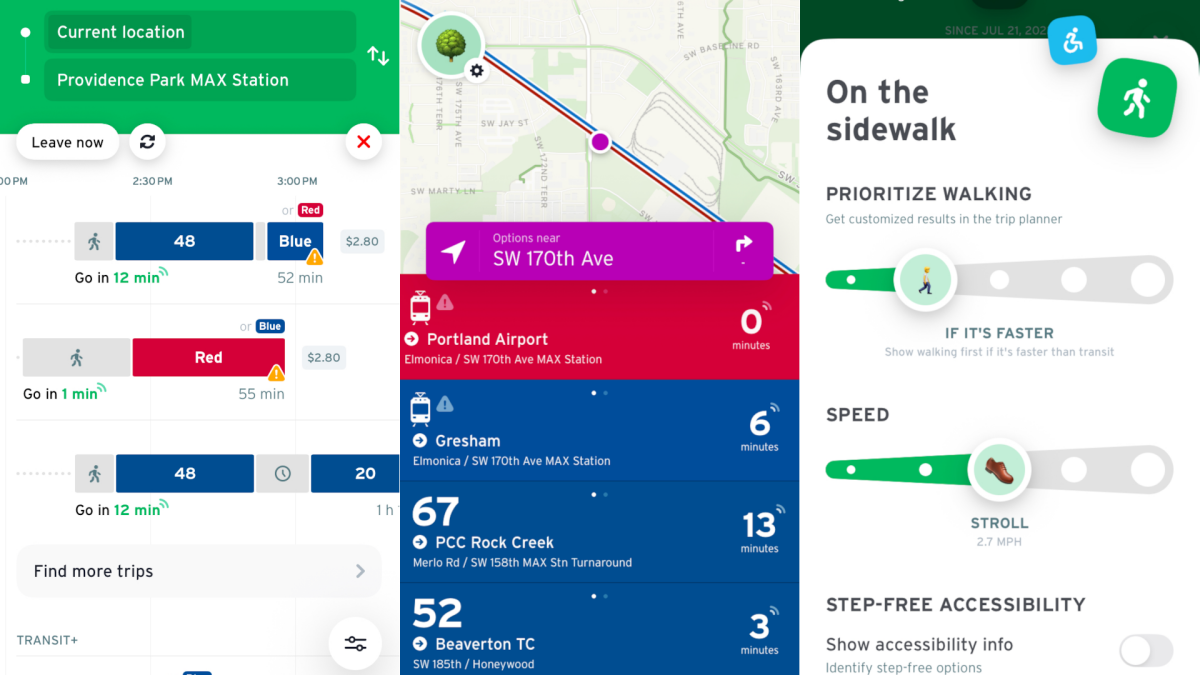
This free app is perfect if you ever find yourself waiting for a bus, train, or any other form of transportation. Just open the app and you’ll see the next departure times for all lines near where you’re standing. You can tap any line to see a more detailed schedule. You can usually also see where the next train or bus is, right now, thanks to real-time data.
All of this removes the anxiety from using public transit. Instead of wondering when the next bus will get there—or if the next bus is coming—I can glance at my phone and know exactly how long I need to wait. I live near Portland, Oregon and use this feature basically any time I go into the city—it’s just nice to know when the next train is coming.
But the application has also saved me while traveling. Once, while biking north of Victoria, British Columbia, one of my tires went flat. Walking back to the city would have taken hours and I didn’t have any cell signal. The Transit app, miraculously, had a cached version of the bus schedule and pointed me to a nearby stop. I caught a bus 15 minutes later and made it back downtown quickly.
Credit: Justin Pot
Even outside emergencies, Transit makes navigating new cities via public transit a lot less intimidating. In addition to real-time departures, there’s also a way to ask for directions, the same way you can Google or Apple Maps. And while those applications both offer transit directions, the Transit app does a better job at offering multiple routes.
What do you think so far?
This app also makes it easy to tweak for the way you ride. I, for example, am happy to walk a couple miles if it means avoiding a long connection spent sitting at a bus stop. Transit lets you configure how long you’re willing to walk and how fast you walk. There’s also really great support for combining bike and transit, something that Google and Apple Maps don’t really offer. The result is that you can generally get around faster using Transit’s directions once you configure it to match your preferences.
Transit works in 951 cities around the world, mostly in North America and Europe. There’s a paid version, called Royale, that provides access to things like more complete schedules and customization options. These features are offered free of charge in certain cities, a fact I learned during a recent visit to Grand Rapids, Michigan. If you’re a regular user of public transit, or even just someone who likes to use public transit when you’re visiting a new city, I highly recommend you give this application a try.